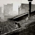
1871: Rosalie Goodman, the Crazy Cat Lady of New York’s Lower East Side » Delancy Farm Map
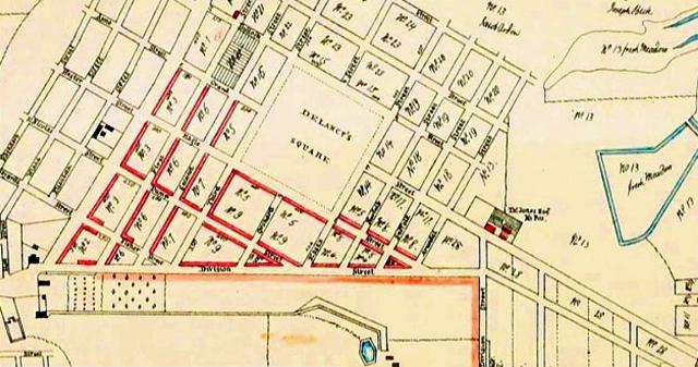
In the 1700s, Division Street marked the east-west dividing line between the farms of Hendrick Rutgers and James Delancey. This map, titled “James De Lancey’s Map or Plan of His Bowery Farm In the City of New York As it Was at the Time of the Revolution,” shows that Division Street between Essex and Norfolk streets was catty-corner to Delancey’s Square – pun intended. All the blocks around Delancey’s Square were laid out by the family in the 1760s.
James De Lancey’s Map or Plan of His Bowery Farm In the City of New York As it Was at the Time of the Revolution