
1944: Brownie Gavan, the Canine Squire of Kingsbridge (Bronx) Who Prevented a Burglary on Godwin Terrace » 1890SketchKingsbridge
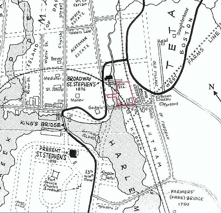
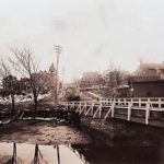
Godwin’s Island and the foot bridge is depicted on this 1890 map. (Back then, Kingsbridge Avenue was called Church Street and Corlear Avenue was called Water Street.) This map also clearly labels the Godwin and Moller houses, and the 35th Police Precinct, which occupied one of Godwin’s buildings (much of the land surrounding the police station was soggy marshland).
Godwin’s Island and the foot bridge is depicted on this 1890 map. (Back then, Kingsbridge Avenue was called Church Street and Corlear Avenue was called Water Street.) This map also clearly labels the Godwin and Moller houses, and the 35th Police Precinct, which occupied one of Godwin’s buildings (much of the land surrounding the police station was soggy marshland).