 More than a century before the World Trade Center was attacked on September 11, 2001, and about 25 years before the site became known as Radio Row (a small business district specializing in the sale and repair of radios), Cortlandt Street was home to numerous factories and loft buildings. And lots of stray cats.
For one sassy little bull terrier who resided in the lower end of Cortlandt Street–right about where the South Tower of the World Trade Center would later rise and fall–these street cats were prime targets for his daily bullying. In fact, the bully bull terrier had a reputation for “shaking the life half out of the neighborhood cats.”
As the Stylistics sang in the 1970s, payback is a dog. A very large mastiff, that is.
In 1894, there was a candy factory in the upper floors of the five-story loft building at 69 Cortlandt Street. The factory was guarded by a 185-pound mastiff who, when standing upright on his hind legs, was 6 feet 6 inches tall.
According to a reporter for the New York Sun, this mastiff was a sober and serious dog who had a reputation for minding his own business. He would sometimes see the bull terrier on his daily walks, but he usually ignored the smaller dog’s antics. Then one day he decided to put an end to the cat bullying.
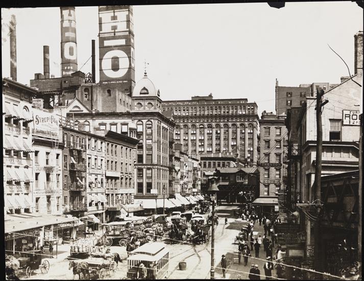
Here’s a view of Cortlandt Street, looking east from the ferry depot on West Street, in 1886. The candy factory at 69 Cortlandt Street would have been on the right. I don’t see any cats, but I’m sure they were hiding somewhere. Museum of the City of New York Collections.
On this fateful morning, the mastiff was coming down the stairs with the boy who walked him every day when he saw the bull terrier being lead on a chain across the street. He bounded down the steps and “caught the astonished, but pluckily silent, terrier by the neck, and began switching him about, chain and all, until the passengers coming up from the ferry could not tell whether it was a dog or a white rag that was being worried. The mastiff just stood still, with his head high in air, and had fun with the 35-pound tormentor of cats.”
The man walking the terrier grabbed a stick from a truck and started beating the mastiff off while a truck driver pulled at the larger dog’s tail. Then someone threw a bucket of ice water on the big dog, which made him gasp, and the little dog dropped from his mouth and scooted away.
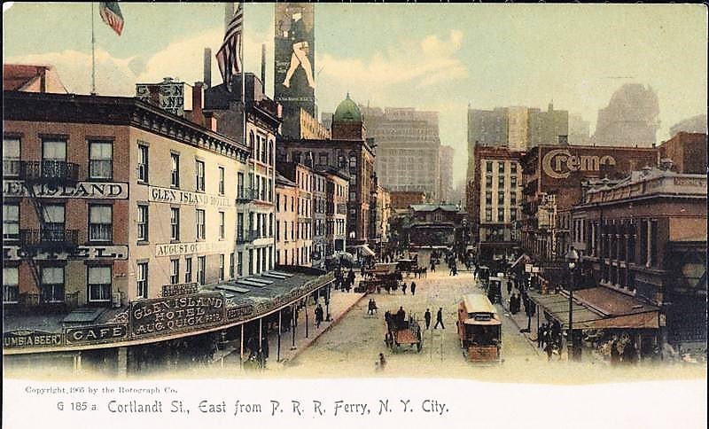
Here’s the same view of Cortlandt Street looking east from the ferry on West Street in 1899. Museum of the City of New York Collections
“The mastiff swaggered off on his morning stroll with the air of saying, ‘Of course I could have bitten that little beast’s head off if I’d wanted to, but I only wanted to show him how it felt to be shook.’”
As the reporter noted, that day the cats of Cortlandt Street “enjoyed the privilege of the street…undisturbed.” I don’t know what happened to the bull terrier after this incident, but I have a feeling the cats only got a one-day respite.
A Brief History of Cortlandt Street and Mulford Martin
Prior to 1735, which is the year Cortlandt Street was laid out, this area of Manhattan was part of the southern border of Trinity Church’s “Church Farm”–known earlier as the “King’s Farm”–which went as far north as present-day Christopher Street. The street is named after Oloff Van Cortlandt, a rich brewer who arrived in New Amsterdam in 1637. Van Cortlandt served as burgomaster from 1655 to 1666, and he owned the land on which the street was laid.
In 1807, Robert Fulton began scheduled ferry service from the foot of Cortlandt Street to Albany via the Hudson River on a boat called the North River Steamboat (it was later called the Clermont.) Ferries also ran from the Cortlandt Street Ferry Depot to New Jersey in later years.
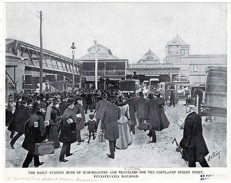
The Cortlandt Street Ferry was a busy place in 1899. NYPL Digital Collections
From the middle to the late 1800s, the property on which this cat-and-dog story of Old New York takes place–specifically 69 Cortlandt Street–had belonged to Mulford Martin, a New Jersey native who worked as a grocer and trader (he and his brothers Peter and William worked together in a firm called Mulford Martin & Co.).
Mulford married Sarah Ann Patchen in 1821, and through this marriage he inherited a vast amount of land in Brooklyn formerly owned by his father-in-law, Ralph Patchen.
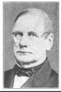
Mulford Martin
Ralph Patchen had made his money as a butcher in the old Fly Market, which was located in Manhattan at the foot of Maiden Lane on the East River from the seventeenth through early nineteenth centuries. Sometime around 1802, he purchased about 150 acres in Brooklyn along the East River from William and Isaac Cornell, the sons of British loyalist Whitehead Cornell.
Patchen’s land was bounded by State Street, Amity Street, Court Street, and the East River (it also included some land under water). In early years, the property included a farmhouse near the intersection of today’s Atlantic Avenue and Henry Street, a distillery near the foot of today’s Joralmon Street, and a dock near present-day Henry Street.
Over the years, the land under water was filled in and the former farm was developed with additional wharves, piers, dwellings, stores, stables, and warehouses.
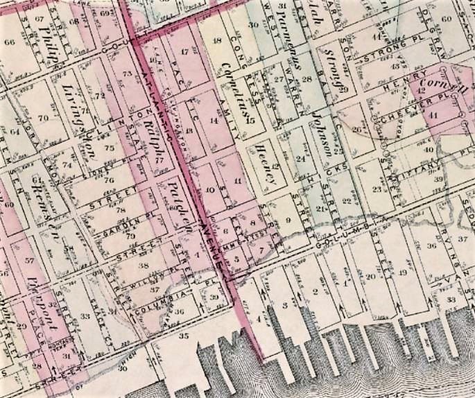
Much of the land straddling the northern end of present-day Atlantic Avenue (in pink on this 1874 map) was the farm of Ralph Patchen and his wife, Fanny Van Dyke. Prior to 1855, Atlantic Avenue was a private roadway called Patchen’s Lane, which lead from the farm to Red Hook Lane (laid out in 1760 and now called Court Street). This country lane was later called District Street, which became the southernmost boundary of the Village of Brooklyn, incorporated in 1816. In 1855, District Street was renamed Atlantic Street. By the 1870s, this main thoroughfare was designated Atlantic Avenue.
In addition to the Brooklyn property that he inherited following the death of his father-in-law, Mulford Martin also owned several lots on Cortlandt Street and along Broadway. According to newspaper reports, Mulford and Sarah Ann were living in a home at 69 Cortlandt Street as early as 1868, where the five-story loft in this story was later erected. The couple had eight children: three daughters and five sons.
The Martin family reportedly worshiped money, so there was much jealousy among the siblings when Mulford passed away in 1873. The patriarch left the majority of his estate to his eldest son, William Augustus, limiting his daughters to “respectable portions” of $100,000 each. (I don’t know what, if anything, the other sons received.)
The three daughters contested the will, but in the end the favored son prevailed, inheriting about $3 million worth of real estate, including the family home at 69 Cortlandt Street, a house at 512 Broadway, and the land in Brooklyn. William Martin sold most of the land for development; he also leased his land on Atlantic Avenue in Brooklyn to the Long Island Railroad for its depot.
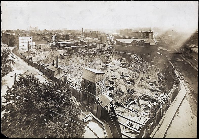
The Long Island Railroad Depot was constructed on the old Patchen farm in 1900. By this time the land was owned by Patchen’s grandson, William A. Martin. NYPL Digital Collections
Sometime prior to 1892, the Martin’s home at 69 Cortlandt Street was replaced by a five-story loft. Some of the businesses that operated out of this building in the late nineteenth century were Herron & Spencer (importers and dealers in nuts, vanilla beans, glucose, vanilla beans, and grape sugar), F.E. McAllister Company (which sold all kinds of bird food and seeds), the Mill End Tailoring Company, Michigan Wheel Company, Clinton Manufacturing Company, Prentice Wireless Company, and Liberty Fountain and Gold Pen Company.
Radio Row
In 1921, business owner and entrepreneur Harry L. Schneck opened City Radio on Cortlandt Street. From this small shop that sold radios and radio parts evolved an entire business district dedicated to radios. One of the larger shops in the district was Leonard Radio, Inc., which occupied the five-story loft building at 69 Cortlandt Street.
In 1966, the Radio Row district was demolished and its streets were de-mapped to make way for the World Trade Center. Cortlandt Street, which had then run to West Street, was cut back several hundred yards to Church Street, reducing it to one block.
In 2014, the de-mapped portion of Cortlandt Street was named Cortlandt Way as part of the development of the new World Trade Center. The newly opened portion of the road, which is not accessible to vehicles, lies between Three and Four World Trade Center.
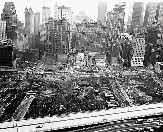
The old loft buildings of Radio Row along Cortlandt Street were demolished to make way for the World Trade Center, shown here under construction in 1968. NYPL Digital Collections

Thanks for another fascinating story!