Part I of a 2-Part Cat Tale
Fishing at Dyker Meadows
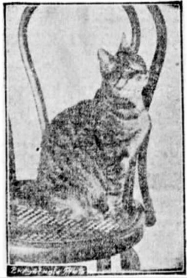
Lillian Russell, the feline mascot of the Dyker Meadow Golf Club, was a remarkable cat who often fished in the ponds on the old Cortelyou property along the Narrows.
In 1821, Peter Cortelyou wrote a letter to William J. Lott concerning some local fishing practices that he thought could jeopardize the Cortelyou family fishery. The fishery was located on the Narrows at the foot of present-day Battery Avenue, adjacent to Dyker Meadows and what would later become Fort Hamilton in Brooklyn.
According to John McPhee, author of “The Founding Fish,” Peter had used the very same fishing practices that he was now complaining about (the use of balloon-like fyke nets held open with hooks). In fact, between 1789 and 1795, Peter reportedly caught over 100,000 shad using the nets.
By 1821, when Peter wrote the letter to William, his catch was down 96 percent, the result of over-fishing in the Narrows.
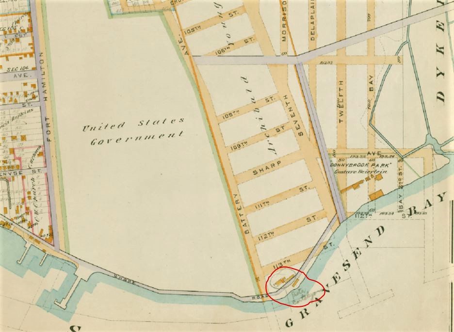
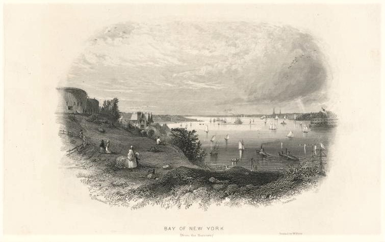
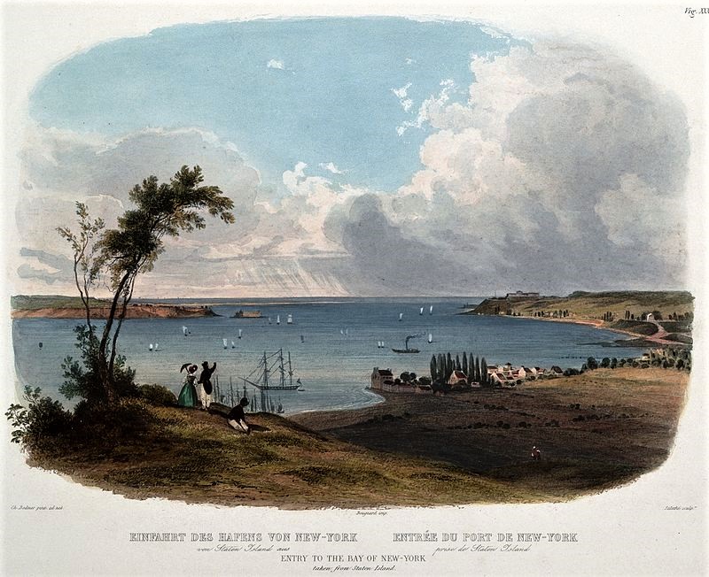
Although the Cortelyou family may have depleted almost all the fish in the Narrows by the early 1800s, fishing in the three natural ponds at the new Dyker Meadow Golf Club was still quite popular 100 years later. Only this time the main angler was a female cat named Lillian Russell.

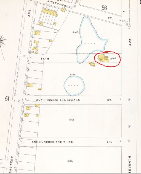
Lillian Russell was a large tabby cat who served as the feline mascot for the Dyker Meadow Golf Club, located along 7th Avenue between 92nd Street and the waterfront in the Fort Hamilton section of Brooklyn (now the site of the Poly Prep Country Day School). Named for the famous American actress and singer, Lillian Russell had arrived at the clubhouse in 1900, five years after the links were established.
Lillian was reportedly a very intelligent cat, and all the members adored her. There wasn’t an annual dinner at the Dyker Meadow clubhouse that didn’t feature toasts to Lillian or songs about the beloved cat.
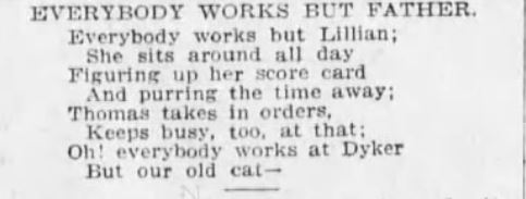
Like Peter Cortelyou, Lillian was especially adept at fishing. According to news reports, one of Lillian’s skills was diving into the deep ponds to catch fish. In warm weather when the caddies were on the grounds, Lillian would follow the men and steal the fish from their pails or baskets when they weren’t looking. She often finished off her fish meals with graham crackers or pumpkin pie from the clubhouse.
If the fish were in low supply, Lillian would catch the mice in the meadows along Gravesend Bay. As one member noted, she would return from the meadows soaking wet with a mouse in her mouth for her offspring—of which she had quite a few.
In 1904, a litter of five kittens dominated a news story about a golf tournament that had taken place at the Dyker Meadow course. Following a few paragraphs about Lillian and her kittens, the reporter added a brief aside, “Incidentally it may be remarked that there was yesterday a nine-hole selected golf ball sweepstakes.”
The participants at this event, whose names were relegated to a few bottom lines of copy in the story, included E.E. Beers, D.R. Aldridge, A.P. Clapp, J.E. Way, H.F. Browns, and F.H. Wilkins.
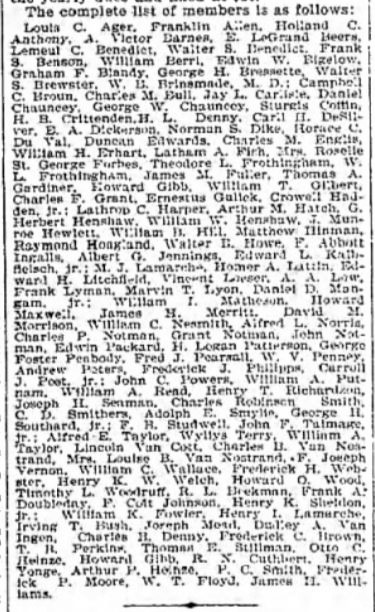
By August 1904, Lillian had given birth to 42 kittens, and by 1906, it was reported that she was the mother of 66 kittens.
Fortunately, there was a very high demand for her progeny among the 100+ club members. In fact, a waiting list was established for Lillian’s kittens.
In Part II of this story, I’ll tell you more about Lillian and her kittens. If you’re interested in learning more about the fascinating history of Dyker Meadows, read on…
Dyker Meadows: The Colonial Days
Dyker Meadows was once just a vast wasteland of marsh, swamps, and meadows. The Canarsie Indians and the first Dutch settlers reportedly referred to the meadow land as the “common land” because they were unable to farm the swampy property or build houses on it.
In 1652, Camelis van Werckhoven, an influential stockholder in the Dutch West India Company, came to New Netherland to establish a patroonship near the Narrows. He reportedly purchased what was called “the Nyack tract” from the natives for six shirts, two pairs of shoes, six pairs of stockings, six adzes (a tool similar to an ax), six knives, two scissors, and six combs.

The upper end of Dyker Meadows was a fresh-water swamp with cedar and other trees; at the lower end near the bay only tree stumps and a small beach area remained.
The American Naturalist, 1869
Werchkoven built a log house on the eastern slope of what would later be known as the Fort Hamilton bluff. He also built a mill pond on his property, which included much of the area now occupied by Fort Hamilton and the Dyker Beach Golf Course.
Werckhoven died sometime around 1656 during a return trip to the Netherlands. Because none of his children or other heirs lived in the New World, his children’s tutor and guardian, Jacques Cortelyou, became the de facto owner of the land grant.
In 1657, Cortelyou laid out and surveyed the property and divided it into 20 lots containing 50 acres each. Some of the early Dutch settlers who obtained these lots included Pieter Buys, Joncker Jacobus Corlear, Albert Albertsen, Jan Jacobson, and Teunis Joosten. These men figured out how to drain and reclaim the marshy land by building dykes, just as they had done in Amsterdam (hence, Dyker Meadows).
The original log house on Cortelyou’s property burned down in 1675 and was replaced with a stone house. During the 1690s, when the U.S. government purchased some of the land for garrison use, the stone house was demolished. Workers reportedly used the stones to build a new home for Pieter Cortelyou (Jacques’s son) in 1700; in the 1820s, some of the stones were also used to construct Fort Hamilton.
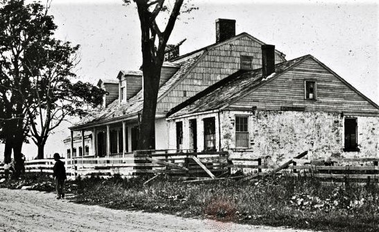
Pieter Cortelyou’s house was constructed around 1700 using stones from the Jacques Cortelyou house. This home was later known as the Simon Cortelyou house (Simon was a great-grandson of Jacques). The U.S. government demolished this house in 1894 “amid profound sorrow by Government officials.” According to one news report, if someone had paid $1,000 for the house it would have been saved.
Dyker Meadows: The Revolutionary Era
During the Revolutionary era, the Fort Hamilton bluff adjacent to Dyker Meadows was occupied by the homes and farms of Denyse Denyse (who operated a ferry to Staten Island), Adrian Bennett, and Simon Cortelyou (the great-grandson of Jacques).
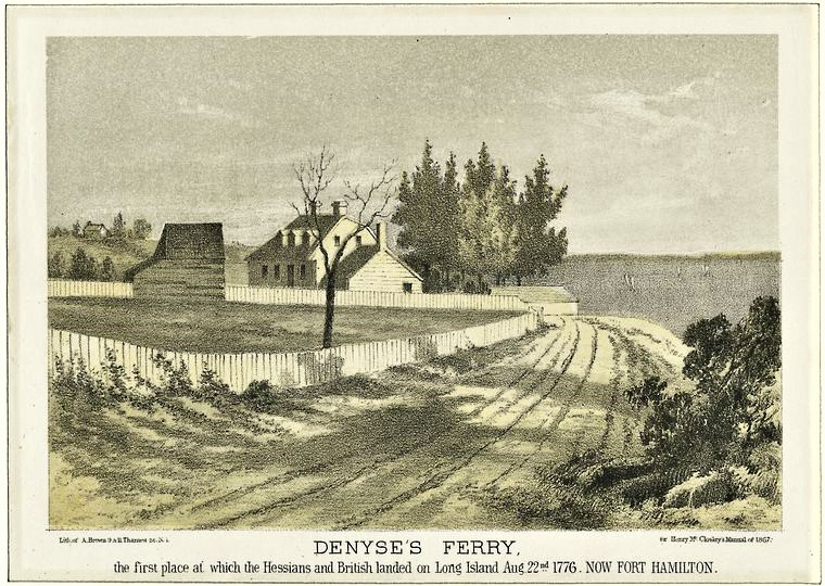
Denyse Denyse and his wife Teuntje acquired the land around the foot of today’s Fort Hamilton Parkway. Old maps show that their house and stone wharf was adjacent to the Cortelyou property (possibly shown in the distance at left). Museum of the City of New York Collections
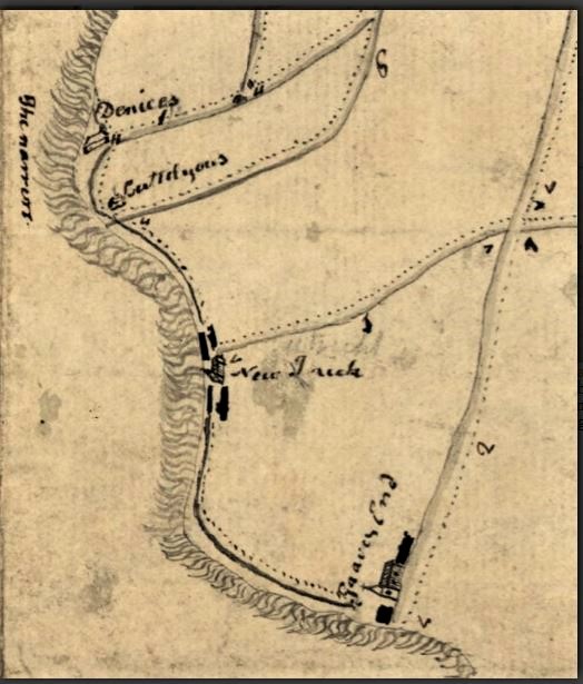
On August 22, 1776, several thousand British troops and their Hessian allies landed on the bluff at Denyse’s ferry wharf with plans to force George Washington out of New York. American patriots who had been keeping a small battery of cannons on the bluff fired upon British ships gathered in the Narrows.
The British returned fire, with one cannonball getting lodged in the chimney of the Bennett house and another causing damage to the Denyse house. The Cortelyous were reportedly Tories, so their house was left unscathed.
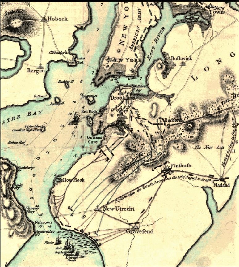
This British military map from 1776 shows the marching routes and battle sites during the Battle of Long Island in August 1776. Note the paths leading from the Narrows; this was the site of Denyse Denyse’s ferry wharf at Dkyer Meadows.
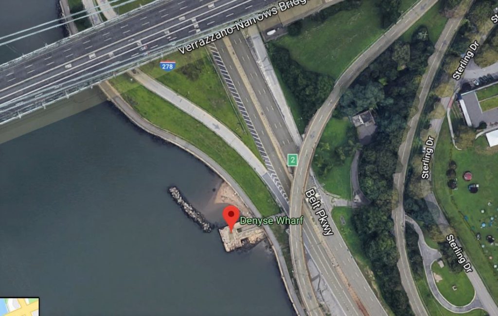
The crumbling Denyse Wharf jetty still marks the spot where the British soldiers entered and existed New York in 1776 and 1783. The wharf is padlocked and only accessible by walking or biking on the 4th Avenue overpass on the Belt Parkway. Google satellite image
Dyker Meadows: 1836-1890
After the British took control, the Dyker Meadows were abandoned and once again declared common property for use as general pasture for cows and sheep.
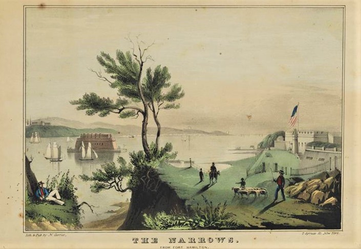
In 1836, William Post purchased the Cortelyou property; following William’s death in 1841, the property went to his widow and four children: William G. Post, Sarah, wife of Christian B. Morrison; Jerusha, wife of James H. Sackett; and Matilda, wife of Isaac C. Delaplaine.
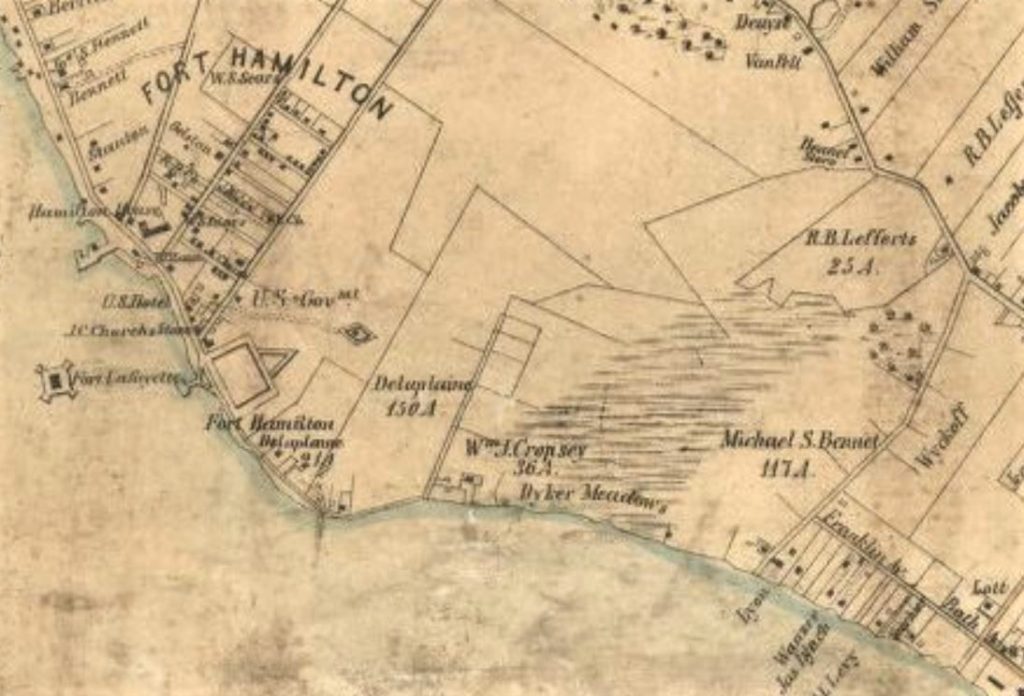
In the 1850s, as shown on this 1852 map, the former Cortelyou property on which the Dyker Meadow Golf Course would later be built was owned by Isaac C. Delaplaine, the son-in-law of William Post. Delaplaine’s closest neighbors at Dkyer Meadows were William J. Cropsey and Michael S. Bennet.
The lands retained their character as commons until the 1870s, when they were purchased by Archibald Young (who played a large role in the development of Bath Beach) and Barney Williams, a well-known actor.
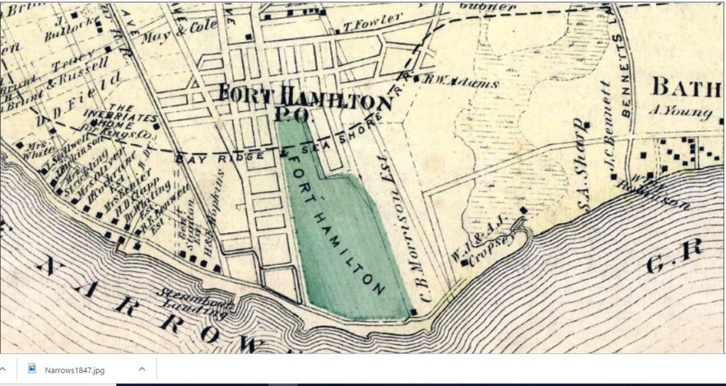
Archibald fenced in the land to keep the cattle out, and he hired private watchmen to guard the fields. These actions created havoc among the local residents; many of them threatened Archibald with bodily harm.
Eventually, Archibald Young rented out his property as pasture grounds, but by 1894, big changes were being planned for Dyker Meadows…
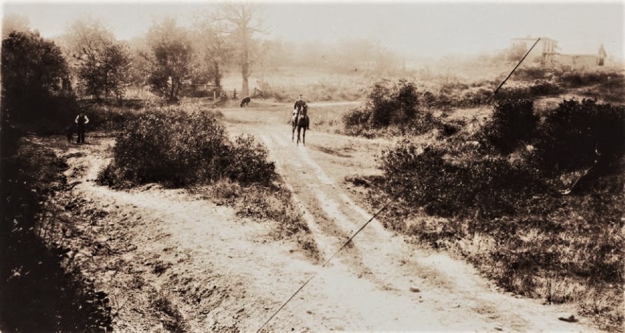
The intersection of Cropsey Avenue and 7th Avenue at Dyker Meadows around 1894 (the road was scheduled to be improved that year). The Solomon A. Sharp residence, formerly the residence of Michael S. Bennett, is in the background at right. Also notice the sheep in the center background. One year later, this land would be part of the Dyker Meadow Golf Course, where Lillian Russell the mascot cat made her home. NYPL Digital Collections
In Part II of this Brooklyn cat tale, I’ll tell you more about Lillian Russell and the Dyker Meadows Golf Club.
